Drones and zones: Taking a remote view of water
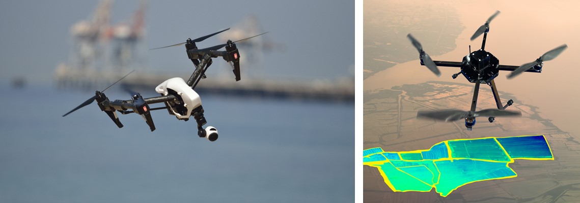
Breakthroughs in ICT and related fields have prompted a surge of interest in the use of drones and other remote sensing techniques to support water asset owners, municipalities and others monitor their network.
Taking a remote view of water
Mega trends such as climate change and increasing urbanisation are prompting water asset owners turn to better and more dynamic monitoring methods.
Advances in a number of related technologies such as electronics, IT and communications have seen arial and aquatic unmanned aerial vehicle (UAVs) as well as other remote monitoring techniques rapidly emerge as a viable option and, quick to catch on, the water sector is one of the early adopters.
Urban expansion and the related growth in impervious surfaces, coupled with the impact of climate change and aging infrastructure are increasing the likelihood of high impact flooding events in towns and cities.
With the aim of increasing resilience and the options for mitigation in the wake of recent flash flood events, the city of Dudelange in the south of Luxembourg has been the focus of new research from the University of Luxembourg and RSS-Hydro.
This recent study has been attempting to establish a benchmark for urban flood modelling using high-resolution 3D mapping data acquired from different airborne platforms such as UAVs and satellites.
According to the researchers, urban flood modelling is particularly challenging given that most modelling is currently based on low-resolution bare earth models. These models typically do not include sufficient data on important elements like drainage networks that allow the accurate prediction of flooding events.
“Urban flood modelling is particularly challenging given that most modelling is currently based on low-resolution bare earth models.”
Using low altitude drones equipped with Lidar and cameras, higher altitude aeroplane and higher still satellites, the research has generated a large, high quality, multi-modal and multiscale topographic data set.
Mooted as a first step in developing a precise 3D urban terrain model to feed into state-of-the art flooding models, the aim is to optimize the urban flood modelling and inundation predictionsexecuted by RSS-Hydro.
Flying underground
A rather more down to earth approach to remote monitoring is underway in Spain, where a micro UAV is being used to monitor and inspect Barcelona’s extensive sewer network.
The Aerial Robot for Sewer Inspection (ARSI) consortium established proof of concept in the first phase of this innovative project. It uses a multi-rotor-type micro aerial vehicle (MAV) equipped with data collection and navigation sensors.
Capable of semi-autonomous navigation and data collection while communicating with an on-surface operator, the MAV avoids mobility constraints that would affect terrestrial vehicles. It also eliminates the need for humans to investigate the challenging and often hostile environment that is found in an urban sewage network.
Fomento de Construcciones y Contratas (FCC), which has maintained Barcelona’s 1,500 km sewerage system since the early 1900s, worked with Ibak Helmut Hunger Gmbh & Co. Kg, Simtech Design S.L and EURECAT to develop the solution.
While the use of flying vehicle within the sewer may seem counterintuitive, the consortium notes that in fact a MAV avoids many of the mobility constraints associated with such environments.
Narrow galleries and passages with irregular ground, steps and steep slopes, trash and wastewater are all major challenges for both humans and ground-based automated vehicles. A flying platform is also able to move more quickly through the sewer network.
And, while significant constraints on the size of the vehicle do limit the available payload, a carefully designed package, including an embedded PC, 2D laser scanner, multiple image sensors, LED lights, a gas sensor and an antenna, minimised the weight and energy requirements.
As a result, the first phase of the project successfully demonstrated the proof of concept in terms of mobility, autonomy and communications. A second phase is now underway during which the solution will be developed and validated to ensure robot-assisted sewer inspection is possible.
Assessing water quality using drones
More recently, UAVs have been adopted by New Zealand’s Auckland city council as part of a water quality monitoring project.
Working with engineering and environmental consulting firm Pattle Delamore Partners (PDP), Auckland is using drones to take water samples as part of the city’s Safeswim initiative.
Safeswim is a partnership between the Auckland Council Group, Surf Life Saving Northern Region and the Auckland Regional Public Health Service which provides real-time data on the performance of the wastewater and stormwater networks, forecasts of water quality at around 100 sites around the city.
Some estimates this remote monitoring approach could save up to 30 per cent on the operating costs of monitoring water quality where previously boats and helicopters were used to collect samples. The drone collects samples at up to 1km offshore.
Similarly, the Delft-based Indymo uses drones to collect samples and water quality data. However, the Netherlands firm uses underwater drones to inspect and monitor water systems.
In 2017, for example, Indymo partnered with Ecological observation and wetlands conservation (Ecoton), the Indonesian water board Jasa Tirta 1, the river basin management organisation BBWS and the technical university of ITS Surabaya to collect water quality data on the Brantas- and Surabaya rivers in Indonesia.
The drone is used for dynamic monitoring and is equipped with an array of water quality sensors to explore factors such as dissolved oxygen, electrical conductivity, chlorophyll, blue-green algae as well as sonar and video cameras.
Experience at Anglian Water
Beyond drones, other types of remote sensing technology are also being explored by water companies.
In the UK, for example, Anglian Water is trialling a fibre optic cable to detect leaks in their water distribution network. In an alliance with Kier and the Craley Group, Anglian is using Craley’s iSMTM technology on a Kier-designed model section of pipework at a site in Lincolnshire.
The fibre optic sensor cable acts as an array of virtual sensors and has the potential to continually monitor the pipeline for leaks and other events with the information processed in real-time.
“This technology has the potential to revolutionise the way we find and fix leaks.”
In a statement Hayley Bruce, Project Manager for Anglian Water, said: “This technology has the potential to revolutionise the way we find and fix leaks across our water network.”
Certainly, remote monitoring is set to have a significant impact on how water assets and related infrastructure is investigated, monitored and managed. With new approaches to remote monitoring emerging more rapidly, even more innovative approaches to data capture are expected to emerge in the coming months and years.

.jpg?h=628&iar=0&w=1200)